Finished Project
This page refers to a project that is no longer active and so information here may be out of date or otherwise incorrect.
Modelling Mosquito Flight with SWOTS
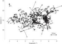
Spatially targeting malaria control interventions in areas of high disease burden will become a more cost-effective and sustainable approach for national programmes in the era of elimination. To achieve this the geographical scale in which to implement control and identify the most likely sources and routes of infection are critical. Wind-assisted mosquito dispersal is an important, yet currently undervalued, source of information to track the spread of malaria and predict outbreaks. We will develop and apply a model, previously and successfully used to track the wind-borne spread of Bluetongue virus by midges, to predict the spread of malaria in a rural region of southern Malawi. The ‘spatial-temporal wind-outbreak trajectory simulation’ (SWOTS) model developed by Luigi Sedda and colleagues at Oxford, will use wind data, household infection status and insect flight parameters to determine the most likely source and route of infection during the rainy season. We will empirically validate the output from SWOTS using a simple mark-recapture field experiment to determine the influence of wind direction and speed on vector movement.
This pilot project will determine the applicability of SWOTS as a risk assessment and disease preparedness tool for malaria in rural Africa and lay the foundations to extend to other transmission settings and vector-borne disease systems.
The project is funded by a Wellcome Trust Seed Award.


